
- January 19, 2026
- Posted by: Japheth Omari
- Category: News & Updates
Introduction
Kenya’s socio-economic development is fundamentally underpinned by the integrity and reliability of its critical infrastructure systems—transport, energy, water, and information and communication technology (ICT). These networks facilitate trade, ensure access to essential services, and support livelihoods for millions. However, the accelerating impacts of climate change present a profound and escalating risk to these assets. Historical trends and future projections indicate a marked increase in the frequency and intensity of climatic hazards, including riverine and coastal flooding, prolonged droughts, extreme heat, and landslides. These events no longer represent distant possibilities but are immediate, measurable threats with the potential to cause extensive physical damage, disrupt vital services, and incur significant economic and social costs. Consequently, the imperative to transition from reactive repair to proactive, science-based resilience planning has never been more urgent.
The Escalating Climate Risk to Infrastructure
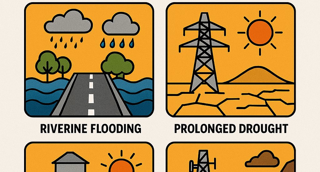
Recent comprehensive national assessments, including the National Roadmap for Climate Resilient Infrastructure (2024), provide a stark quantification of these risks. For instance, analysis under the 2050 RCP8.5 scenario indicates that flooding could inflict direct damages ranging from USD 45 to 99 million on Kenya’s primary asphalt road network. Concurrently, drought exposure threatens up to 55% of the nation’s installed hydropower capacity, a cornerstone of the energy mix. Coastal flooding is projected to impact critical economic nodes, with up to 14% of the Lamu port area at risk. Beyond direct asset damage, the cascading indirect impacts—such as impeded access to healthcare and education due to road washouts, or economic paralysis from power and ICT disruptions—magnify the vulnerability of communities and undermine national development goals, including Vision 2030 and the Sustainable Development Goals (SDGs).
The Imperative of Data-Driven, Forward-Looking Analysis
Addressing these complex, systemic risks requires a paradigm shift in infrastructure planning and management. Traditional approaches, often based on historical data and deterministic design standards, are insufficient in a non-stationary climate. The future climate regime will differ from the past, necessitating planning that is informed by robust climate projections and sophisticated risk modelling.
Modern geospatial technologies and analytical frameworks are now available to make this possible. High-resolution climate models, such as the Representative Concentration Pathways (RCPs) and Shared Socioeconomic Pathways (SSPs), provide probabilistic projections of future temperature, precipitation, and extreme event frequency. These datasets can be spatially integrated with granular asset inventories—down to the level of individual transmission lines, road segments, and boreholes—using Geographic Information Systems (GIS). Advanced tools, including the National Infrastructure Systems Model (NISMOD) deployed in Kenya’s assessment, enable a systematic multi-hazard risk workflow:
- Hazard Mapping: Utilizing satellite-derived data (e.g., CHIRPS for rainfall, digital elevation models) and future climate projections to map flood depths, drought indices (SPEI), heat thresholds, and landslide susceptibility.
- Exposure Analysis: Overlaying infrastructure GIS layers with hazard maps to identify and quantify exposed assets—calculating affected lengths, areas, and population service areas.
- Impact Assessment: Applying engineering-derived damage functions to estimate direct repair and reconstruction costs, and modelling indirect socio-economic consequences of service disruption.
- Adaptation Prioritization: Using the evidence from risk analysis to identify, evaluate, and prioritize context-appropriate adaptation measures, spanning from nature-based solutions (NbS) like catchment restoration to engineered interventions such as flood barriers or upgraded materials.
Why This Knowledge is Indispensable
For professionals engaged in shaping Kenya’s built environment and natural resource management, proficiency in these methodologies is transitioning from a specialised skill to a core competency. The ability to interpret climate projections, manipulate geospatial data, and conduct probabilistic risk assessments is central to:
- Informing Capital Investment: Ensuring that new infrastructure projects are sited, designed, and built to withstand projected climate conditions over their operational lifespans, thereby safeguarding public and private investment.
- Prioritizing Retrofits and Maintenance: Enabling evidence-based decisions on where to allocate limited resources for reinforcing or upgrading existing vulnerable assets.
- Developing Robust Policies and Standards: Providing the technical foundation for updating building codes, environmental impact assessment guidelines, and sectoral master plans to mandatorily incorporate climate resilience.
- Securing Climate Finance: Preparing bankable project proposals that clearly articulate climate risks and resilience co-benefits, aligning with the requirements of international climate funds and development partners.
Conclusion
The resilience of Kenya’s infrastructure is not merely an engineering challenge; it is a foundational prerequisite for sustainable development, economic stability, and social equity. The convergence of advanced climate science, geospatial technology, and systems-level analytics now provides an unprecedented capability to understand and manage these risks. Embracing this knowledge base is no longer optional for the nation’s engineers, planners, analysts, and policymakers. It is an essential duty of care to future-proof national assets, protect communities, and ensure that Kenya’s development trajectory remains secure in the face of a changing climate. The tools and data are available; the imperative now is to build the technical capacity to wield them effectively across all sectors and levels of governance.
This article was prepared by Mr Simon Cherere a Geospatial technologist expert at The University of Nairobi – Institute for climate change.
Join us at the University of Nairobi to turn climate risk into resilient opportunity.
🔗 Register Today: https://forms.gle/DLLpYLvqQVUhFtiC9
#ClimateResilience #KenyaInfrastructure #UoN #SustainableDevelopment #ClimateAdaptation #CivilEngineering #UrbanPlanning #GreenGrowth